On our Hardanger road trip we had reached the southern part, Odda. The ingredients are fjord, snow, fruit trees, industrial plants, a waterfall and a stave church.
Denne artikkelen er også tilgjengelig på norsk.
Along the Sørfjord
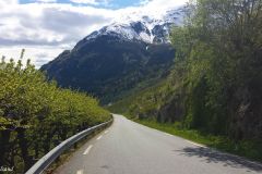
We had spent the morning in Utne and continued on a very good road to the charming little hamlet of Agatunet. Other guests at our Utne hotel had tipped us of taking the old road, running a few metres higher up on the mountain side, for a more picturesque drive. And so we did, at a place called Hauso, for a few kilometres. It was a success.
The same guests had also suggested that a short drive south of Agatunet in the Sørfjord, there would be a road sign stating Reiseter. We found it and rove for the next 4 km uphill on a serpentine road until we arrived at the end of the road.
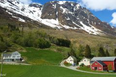
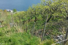
This was farming land, mostly filled with fruit orchards and grazing land for sheep. It was too primarily too steep to grow anything else.
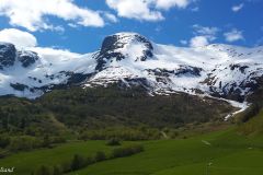
The view of the fjord, quite narrow was lovely. The fields were green, many fruit trees were still in blossom at this time in the beginning of May. The mountains high above us, with snow on top, was breathtaking.
Tyssedal and Odda
The town of Odda lies at the end of the Sørfjorden, which branches off the much larger Hardanger fjord.
According to the municipality, Odda was at the beginning of the 1900s one of Northern Europe’s most visited destinations. In 1904 the town had ten hotels and over 80 cruise calls during the summer season. More than half of all foreign tourists to Norway paid a visit to Odda. The Folgefonna glacier and a number of impressive waterfalls was the primary reason for this.
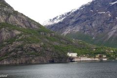
We were driving along the fjord, on the western side, and stopped only to take a few pictures of Tyssedal across the fjord.
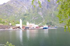
Tyssedal has today an ilmenite smelter, but previously they used to make aluminium here. The first hydropower station in Tyssedal is today part of the Norwegian Museum of Hydropower and Industry. From where we stood we could easily see the huge water pipes running down the mountainside, providing the power to run the smelter.
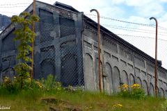
In Odda we also passed a large plant producing carbide and cyanamide. The Odda production was started in 1908 and was at a time the largest in the world.
.
This was how a number of remote Norwegian towns along the coast, and a few inland like Rjukan, were made. The supply of cheap hydroelectric power gave an opportunity to build industry in Norway. Odda and Tyssedal were among the most important.
The Norwegian government has promoted these two factories, and a few more in Norway as possible World Heritage Sites. In the application to UNESCO this is stated: “What makes Odda smelteverk so important and central to the application of Norway’s hydro power sites and pioneer chemical industry as a World Heritage Site is the fact that here in an internationally unique way the physical remains of an early chemical production process are still present”.
Tyssedal and Odda have been almost totally dependent on these industrial sites. The last decades have brought serious problems in terms of keeping the plants competitive. There are some old factory buildings standing right in the middle of Odda with little more than steel and concrete skeletons. The activity inside have ceased long ago and gives Odda a rather drab appearance.
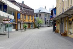
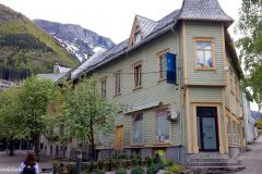
Apart from that the centre of Odda is not that bad. I have passed through the town previously and found it grey and boring, squeezed in between high mountains and with dark clouds as a constant factor. Not today, the sun was shining, the sky was blue and it was a quiet Sunday.
Unfortunately the ten hotels from more than 100 years ago had almost all disappeared. The largest hotel served no lunch but showed us the way to the two places offering something to eat: A stinking fast food place next to the church, and a Chinese. We chose the latter.
The waterfall of Låtefoss
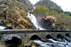
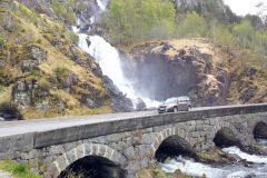
Låtefoss boasts being one of the most visited natural attractions in Norway, and has a location that is very easy to reach. It showers the main road (national road 13) going south from Odda. The waterfall is divided into two races and is therefore called the “twin falls” .
Låtefoss was also a tourist favorite in the 1800s and the early 1900s. Foreign tourists were taken by horse and cart from Odda, over a lake and further up the valley. There was even a hotel here at the waterfall, only remains are seen today.
I have memories of a much wilder waterfall than the one we faced today.
Røldal stave church
After a disappointingly tame Låtefoss we continued on Road 13 south to Røldal for a look at the stave church. Røldal is a small village situated in Hordaland county, not far from the border to Rogaland county. It is also strategically situated on the E134 which goes east-west across the southern part of Hardangervidda. Røldal is a popular ski resort in winter.
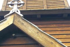
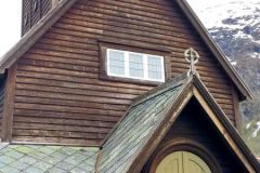
The stave church was of interest to us. It is estimated to be built around 1200-1250. At that time there were between one and two thousand stave churches in Norway, today only 28 remain. One of them is a World Heritage Site. Read up on my entry about stave churches.
The road map of this trip
If you are feeling uncertain of where in the world this is check out this map from Hardanger and Odda:
Further reading
From Hardanger, Odda and Røldal we continued south on Road 13 past Suldal and Hjelmeland to Tau and the ferry back to Stavanger. It had become late in the evening when we could park our car and look back on three days on the road, in beautiful weather, with very nice scenery and much to discover. I have in a previous blog entry described some of the sights that can be seen on Road 13 to Stavanger. There is also a series from another road trip describing the northern part of the Hardanger region. Read it.
This is the story of a road trip in the southern part of the region of Hardanger, in Western Norway. Read the articles:
(6) Sørfjorden, Odda and Røldal (THIS)


