Here is Day 1 of the Boknafjord Road Trip: Haugalandet. This is the recipe for a two-day round trip by car in the beautiful county of Rogaland. The trip circulates the Boknafjord basin.
It is one of the widest fjords in Norway with a number of arms digging deep into the mountainous interior. The scenery is green and lavish, the fjords are deep and the old farmsteads and small towns make this an attractive trip.
The entire route is approximately 480 km, and would take 11 hours to drive without stops. This means that it takes two very long days and can be made at any time of the year, but preferably in the summer. A more relaxing solution would however be to use three days. I made this trip in 1993 and reiterated it this time, in 2013.
The map below gives a sketchy overview of the roundtrip. Zoom in and out, and open the map in a new tab as you like. Details are presented in the text.
There is a Norwegian language version of this article on Sandalsand Norge. LES DENNE ARTIKKELEN PÅ NORSK.
Accommodation and food
A circle has no obvious start or end points. We started out in Stavanger, the largest city in the region. This makes Sauda the most natural place to stay the night, although Sand would have been a choice as well for those seeking a hotel. Our only choice was the boring and overpriced Kløver Hotel in the centre of Sauda. The preferable charming choice, Sauda Fjord Hotel was closed. There is also a campsite offering a place to pitch your tent or a cabin to rent. Owners of mobile homes will have a swell on a multitude of idyllic sites all over the countryside.
Norway has not much to offer in the way of culinary experiences outside the best restaurants in the largest cities. The advice is to leave your taste buds at home; you will not experience much worthwhile savouring on this Boknafjord trip.
Crossing the fjord
The tour starts from Stavanger by ferry at 0735 from the Mekjarvik harbour across the Boknafjord to Skudeneshavn on the very south of the island of Karmøy. The ferry calls on Kvitsøy, a peaceful archipelagic community well worth a visit on another occasion. The Boknafjord is among the widest of the Norwegian fjords with a multitude of small and large islands scattered around it.
Skudeneshavn – the sailing ship town
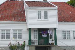
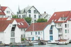
In Skudeneshavn we went for a stroll in one of Norway’s best preserved old sailship and fisheries environments, and stopped by Mælandsgården, the old trading house which has been converted into a wonderful museum. Unfortunately it was closed when we arrived.
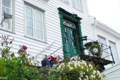
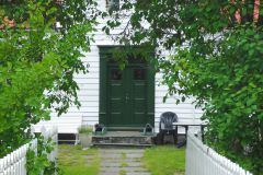
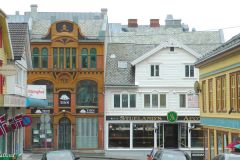
There has been fishing and maritime activity in the natural harbour for centuries. Today we may walk leisurely around in the compact old part of Skudeneshavn, consisting of 125 residential houses and 100 warehouses. The majority was built between 1840 and 1860. The town looks as if nothing has changed in 150 years, apart from good maintenance of the buildings and an abundance of fresh flowers in the small gardens.
Skudeneshavn prospered from the catching of lobster and herring and from a large trading activity with the Baltic countries in particular. By the end of the 19th century the herring fisheries failed, the local ship owners missed out on the transfer from sail to steam – and the little town fell into sleep. It still looks sleepy. And charming.
Being so authentic the town has served as location for several Norwegian films and TV series set in the 1800s.
Video from this visit.
Moving north on Karmøy
Our next stop was to step back a thousand years in time, to around the year 900 AD. We were going to visit the residence of Norway’s first king. That residence, or farm, is believed to be situated at Avaldsnes on the northern end of Karmøy island.
We have two road options on Karmøy, east and west. Unlike in Kipling’s famous poem, the twain do really meet at the centre of the island. We picked the main route along the western coast. This is farming land with a few houses here and there, and some quite nice sandy beaches.
At the centre of the island, in the junction of the two north-south roads, we find Kopervik, the municipal centre of Karmøy. The town was of little interest to us today so we drove by up on the main road. Instead we made a detour to the small harbour of Veavågen to the west. We found a number of old and new residential houses and vacation cottages, and quite a few old fish processing plants and warehouses apparantly abandonded decades ago.
Avaldsnes – Norway’s first “capital”
About 30 km north from Skudeneshavn we arrived at King Harald Fairhair’s royal estate at Avaldsnes. Harald is generally acclaimed to have been the first king to rule Norway, dating back to the late 800s. The decisive battle took place in Hafrsfjord in Stavanger. He had two important estates in the country, here at Avaldsnes and the other at Fitjar further north on the coast of western Norway.
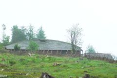
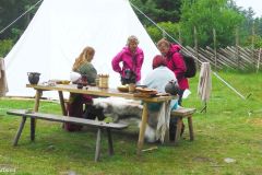
There are major excavations going on at Avaldsnes, but also a lot to see already. The exhibitions at the history centre were fascinating for some of our party, and others found interest in the Viking farm that had been built on Bukkøy, a lovely little island ten minutes on foot from the exhibition centre. Here we found a longhouse, firehouse, roundhouse, several dughouses and a boat house built buy using old techniques.

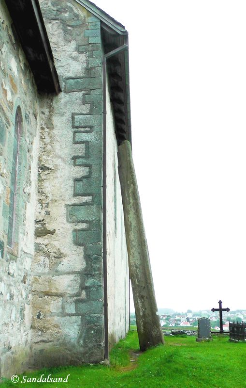
Avaldsnes was a fascinating place to visit, and one could easily spend a half day here. Also located here is the medieval St Olav’s Church, a stone church dating back to around 1250 AD. There used to be a number of monumental stones around the church. One of them remains and it has a name. It is called Virgin Mary’s Needle. Towering 7.2 metres above us it seems to be leaning towards the church, actually stopping 9.2 cm short of touching the wall.
The story goes that “the day of Judgement will come when the stone comes into contact with the church wall“.
Haugesund – the herring town
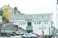
Well, the sewing needle did not hit the church wall at Avaldsnes church when we were there, Doomsday was postponed once again. Running a bit short of time we avoided the interesting Visnes Mine Area. (Copper for the Statue of Liberty in New York was mined here.) Instead we continued a few kilometres north of Avaldsnes into Haugesund, the main town in the region of Haugalandet. It has a long history, prosperous in the 19th century, and quite good at showing off on the national stage with a host of late summer festivals.
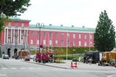
In this Herring Town, as it calls itself, we walked by the lovely, pink coloured town hall (recognised as Norway’s most beautiful of its kind), turned into the very long pedestrian street of Haraldsgata and returned on the bank of the very charming Smeasundet. This sound is a narrow maritime passageway on the north-south axis through Haugesund. It has always been filled with small and large vessels. The number of old warehouses on the opposite side bear witness to the past, and the row of old and new hotels, restaurants and bars on the city centre side are filled with activity all year round.
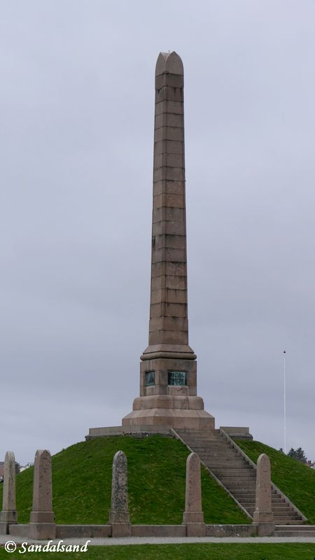
Haraldshaugen
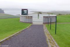
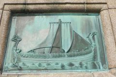
Before leaving Haugesund we returned for a short while to the ancient history of Norway. King Harald Hårfagre (“Fairhair” in English) is said to have been buried in a mound somewhere in this region. On the northern outskirts of Haugesund there is a small hill with a wonderful view of the sea. Haraldshaugen was in the 1860s promoted as the site of Harald’s burial mound. Money was raised and in 1872 they erected a national granite monument celebrating that a millenium had passed since the unification of Norway into one kingdom. The Haraldshaugen has a wonderful setting, with a proud, yet modest and significant monument, and is well worth a visit. There is a 12th century stone cross close to it as well.
Video from this visit, with a few pictures extra from a herring festival in town. The video illustration shows the town hall.
Cutting across Haugalandet
We were now facing a transportion stage of 111 km (2 hours) without many planned stops before arriving Sauda. We took the E134 towards Oslo, passing the junction at Aksdal in Tysvær and later turned onto the R46. Along this road we passed the villages of Øvre Vats, Sandeid and Vikedal. It was a fine drive, but one of the cars had a flat tire. As a consequence, we lost an hour or so.
At Ropeid we turned north into the Saudafjord on the “Dollar Road” high up on the mountainside.Sauda, being a factory town in the deepest branch of the Boknafjord, had a hundred years ago no road connections. Consequently the Canadian owners of the smelter works in Sauda built one. Today this road running the length of the fjord, is a national tourist road.
Jonegarden
We planned to visit Jonegarden, a unique, old farm on the way. In addition we had identified two waterfalls, Honganvikfossen and Svandalsfossen. The Honganvik waterfall proved to be somewhat disappointing and we postponed the Svandal waterfall to the next day. It was getting late.
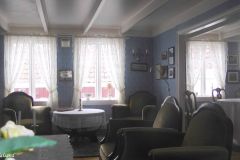
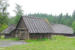
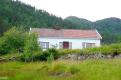
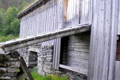
We did manage to squeeze in a stop at Jonegarden. It was a wonderful place. Leave the main road and drive on a gravel road for a few kilometres. There is a parking lot and an even narrower gravel road/trail leading uphill to the farm. The farm consists of a house, a barn and a couple of outhouses. The sign at the parking lot said it would be closed. However, the door to the farm house was unlocked. The interior was just as it would have been late in the 19th century.
We dropped the hike on the scenic nature trail to a waterfall, and returned to our cars. Sauda was our final destination on this Day 1 of the “Tour de Boknafjord”, the Haugalandet part.

Read more
Read about Sauda and the return to Stavanger through the highly picturesque region of Ryfylke, in the next chapter of the Boknafjord road trip.
There are many more relevant articles on this blog. Read my introduction to Western Norway, the fjord country. These posts all have videos describing them in more detail. Watch the videos in the Norway playlist on my YouTube channel.

