Intro
States
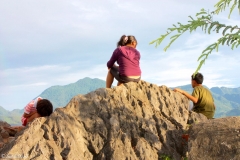
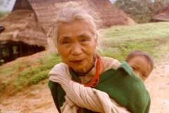
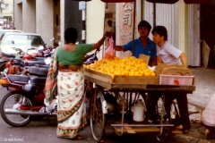
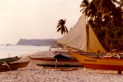
Photos
Blog
Facts
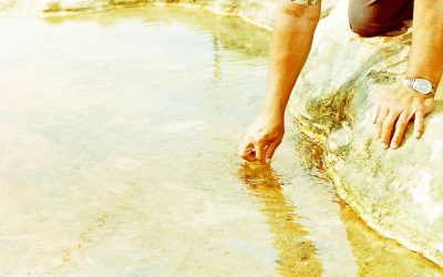
Overall impressions
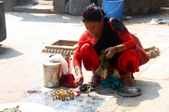
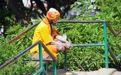
This is a photo of a young lady in the Royal Palace of Phnom Penh, Cambodia. I was wandering around looking up on the wonderful gables or something when she came up the stairs, stopped and took up position right in front of me.
With a big smile on her face, she was clearly ready for a picture. She spoke no English. Apparently her job was to welcome tourists to the marvellous palace area. The famous smiles of Southeast Asia have almost always been earnest, is my experience.
In South Asia I have been to three of eight independent countries, in Southeast Asia to seven of 11, in total 10 of 19.
Click a country name in the list above and find all articles from that particular country. On the map, the yellow coloured countries are Sandalsand’s nine non-visited countries.

Map of South and Southeast Asia. Sandalsand has been to countries marked green, not the yellow ones. (Map source: Wikimedia Creative Commons Attribution-Share Alike 4.0 International)
Photo galleries
Open the box to view Sandalsand’s galleries from this region.
Click to show or hide
For the best experience, open a picture gallery in a new tab or window.


Posts from South and Southeast Asia

Pictures from Bhutan
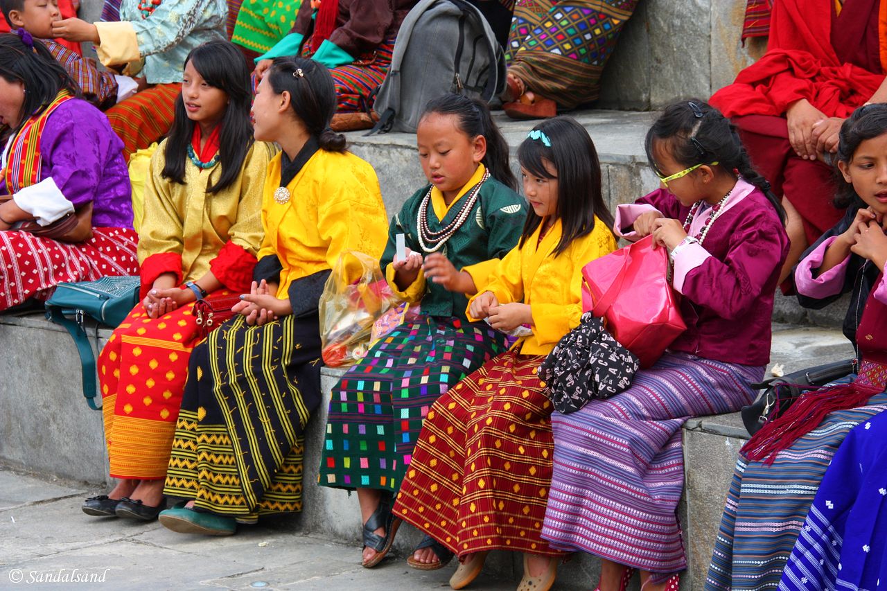
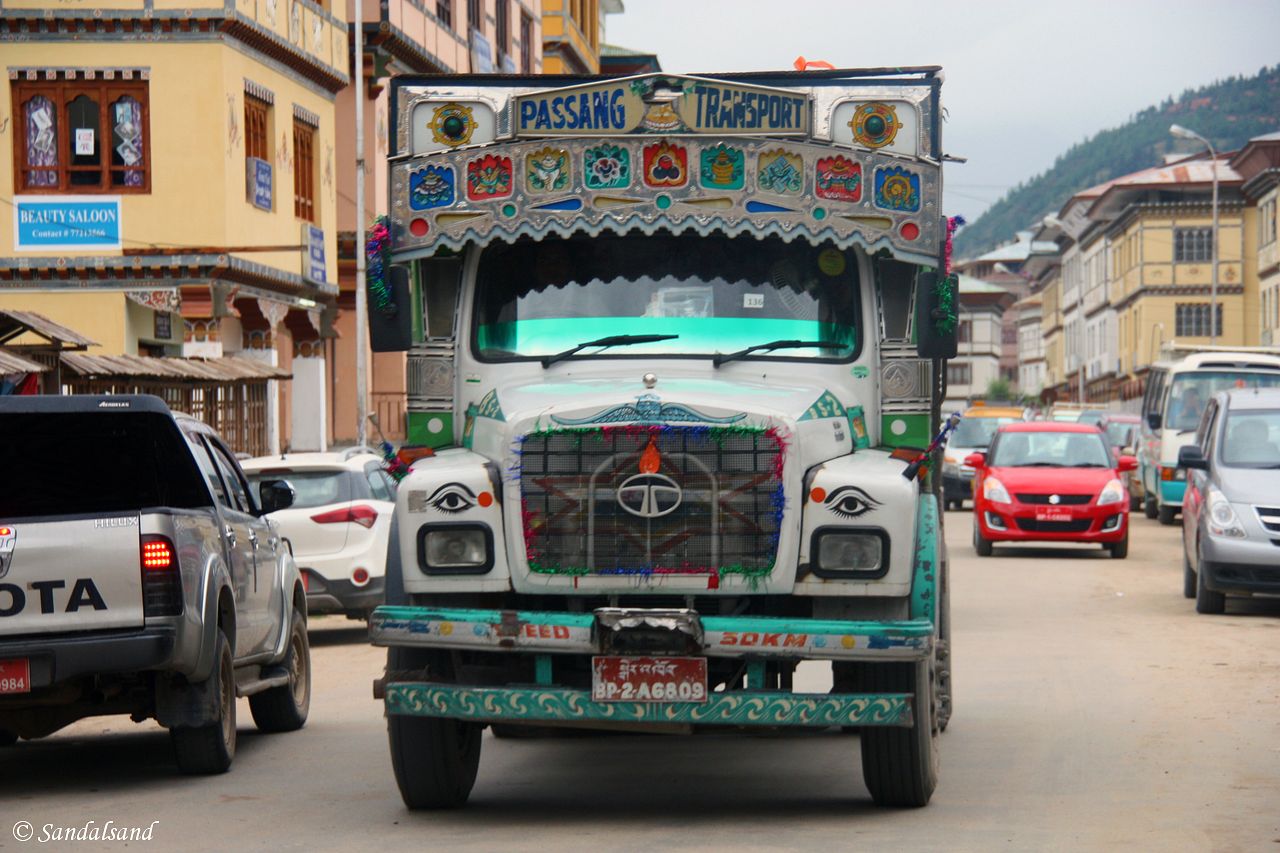
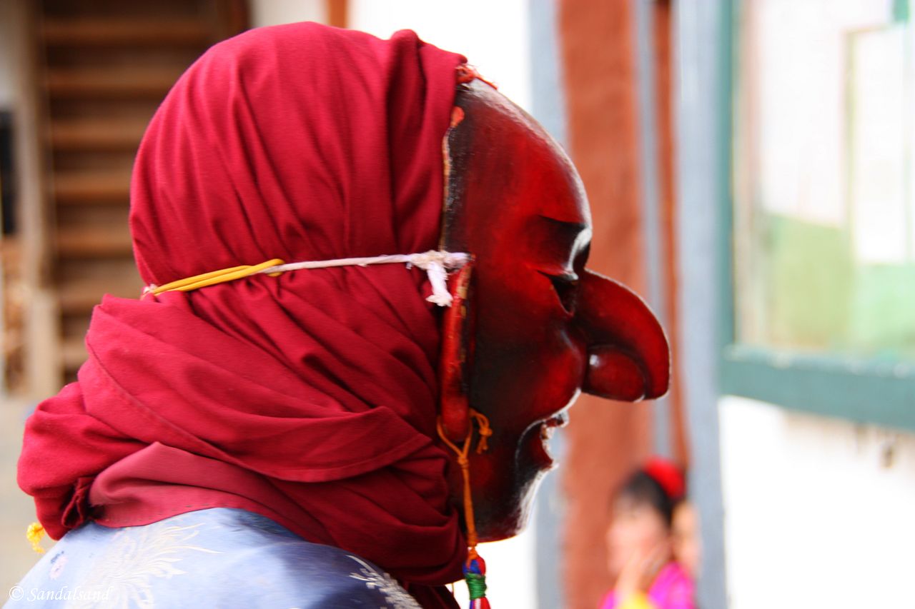
This is a collection of pictures from Bhutan, the result of a road trip in 2015 around parts of the country. Find all Bhutan entries on this...
VIDEO – Bhutan – Tiger’s Nest
This is a video from the Tiger’s Nest (Taktsang Lhakhang). It is one of the holiest of Bhutan's many pilgrimage monasteries, as well as being the...
Visiting Bhutan – Impressions and advice
This article sums up some Bhutan impressions and advice, and background information of a more practical character. My regular travelogue ended in...
The city of Paro, Bhutan
The valley of Paro is generally acknowledged as one of the most picturesque in the country. The competition is hard. There are also several...

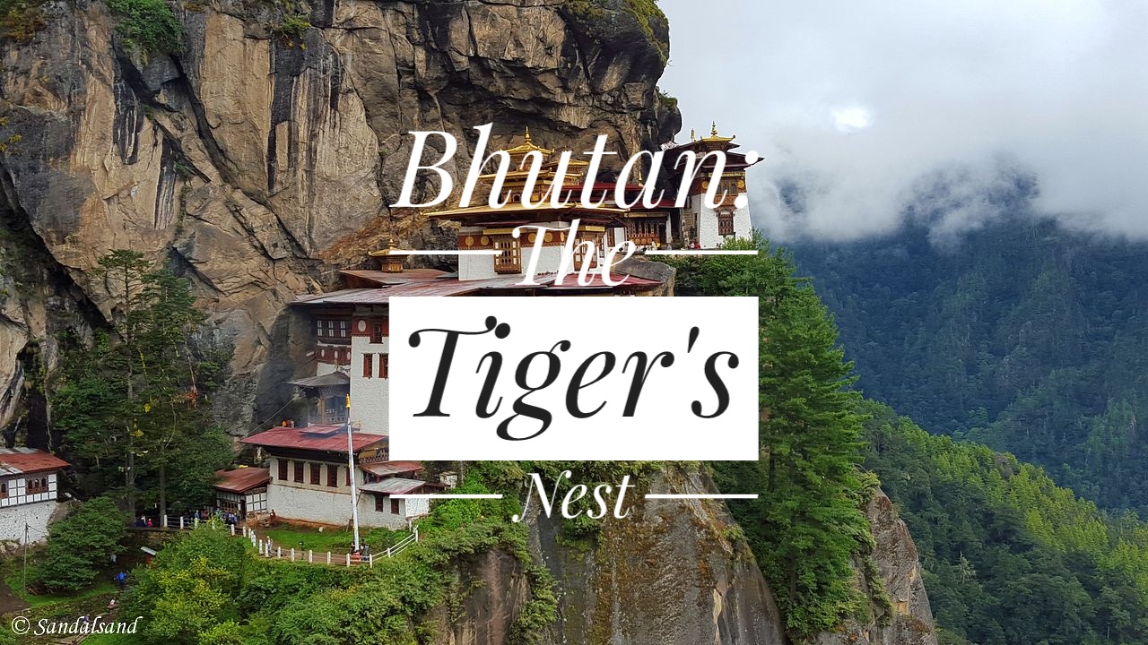
The holy Taktsang Lhakhang (Tiger’s Nest)
Welcome to Bhutan's most iconic landmark and religious site, the Taktsang Lhakhang (Tiger's Nest). The small monastery clings to a sheer cliff face...
The almost hidden Phobjikha Valley in Bhutan
The Phobjikha Valley is not at the end of a five day trek into the wilderness, although you could do that too. For me it was a rather rough car ride...
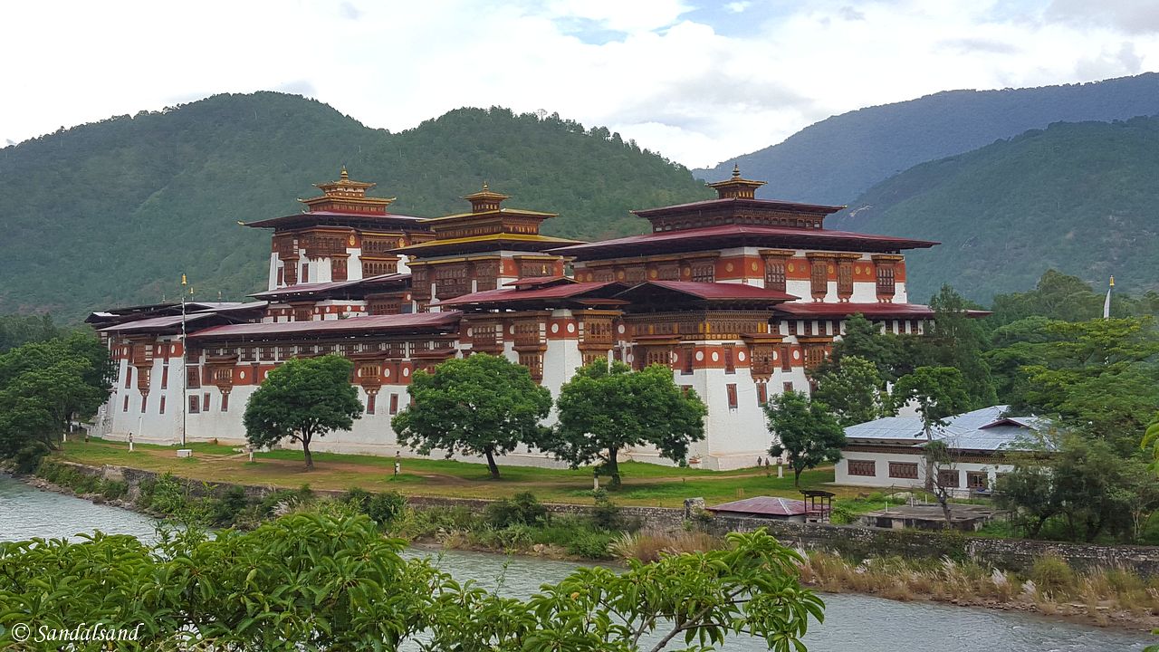
The Dochula Pass and Punakha Valley, Bhutan
Situated in the Himalayas, the construction of roads does not come easy to a developing country. On the other hand, what you meet in the Punakha...
The capital of Thimphu, Bhutan
I was going to Thimphu, the capital of Bhutan. The roar from the aircraft engines came to a stop and I realised I had landed in the Land of the...

Pictures from Thailand
This is a collection of pictures from Thailand. They are from a long journey in 1985 and a revisit to Bangkok 30 years later. The first time I spent...

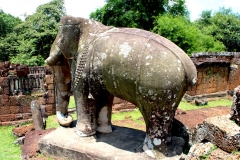
World Heritage #0576 – Ayutthaya
The Kingdom of Siam had its capital in Ayutthaya from 1351 to 1767 and developed a wealthy city full of palaces and temples. Today it is the ruins...
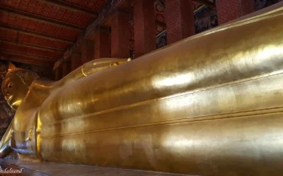
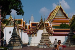
The lovely sound of Wat Pho’s bronze bowls, Bangkok
The Wat Pho temple is a highlight on a visit to Bangkok, with the famous Reclining Buddha and with a reputation of being the birthplace of...
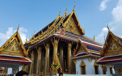
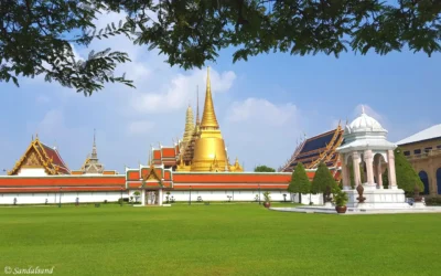
Glitter, gold and emerald in The Grand Palace of Bangkok
The Grand Palace of Bangkok is Thailand's biggest tourist attraction. It is a large complex in the city centre, made up of temples, buildings,...
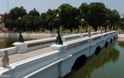
Harmonies in the Bang Pa-In Royal Palace, Thailand
The Bang Pa-In Royal Palace is an unusually tranquil place not far from Bangkok. This used to be the Royal summer palace and still functions...

An excursion to Ayutthaya
After its foundation around 1350 the glorious city of Ayutthaya grew into becoming the second capital of Siam after Sukhothai. The capital benefited...
Summary of a 24 hour visit to Bangkok
A 24 hour visit to Bangkok may not satisfy all. Most visitors to Bangkok will have a hard time getting around to even the most attractive...
The outline of a visit to the Himalayas
This was going to be a visit to the Himalayas, more precisely Bhutan and Nepal, two countries in this magnificent mountain range. This is a summary...
Nature: 5 Important Straits
Let us visit 5 important straits. I have been exploring various aspects of nature with regard to the four classic elements. A strait represents a...
Nature: 11 Picturesque Lakes
Let's have a look at 11 picturesque lakes. Lakes come in all sizes and some even contain salt water. This article illustrates and describes some...
Nature: 9 Fascinating Beaches
I bet you know many beaches. This article is about my selection 9 fascinating beaches. With about 70% percent of the Earth covered by water, there...

Nature: 4 Dramatic waterfalls
Get to know 4 dramatic waterfalls. I am exploring nature in terms of the classic elements of nature. This is a combined water and earth element....
Nature: 7 Active Volcanoes
Here are 7 active volcanoes. Have you seen them? All through the history of mankind fire has fascinated, terrified and calmed us all, and we have...
Nature: 8 Amazing Mountain Views
Have you been to these 8 amazing mountain views? If you take nature as the basis and exclude skyscrapers, constructed "skywalks" and such, we are...
Nature: 7 Strange Rock Formations
What do I mean by 7 strange rock formations? Well, the Earth’s surface is full of loose stones and boulders and solid rocks. Some have over the...
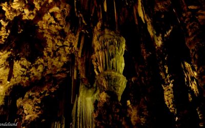
Nature: 10 Great Caves
A cave is a hollow place in the ground, often very deep but also quite small like a grotto. Here is a nice selection av 10 great caves. This...
Poverty with dignity is better than wealth based on shame. (Buddhist saying)
A fact sheet
The Indian Ocean is to the south and on land (clockwise, from west) West Asia, Central Asia, East Asia, and Southeast Asia. This is Wikipedia’s introduction to this region (or regions).
South Asia
Map and numbers
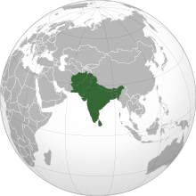
- Area: 5.2 million km2
- Countries: Afghanistan, Bangladesh, Bhutan, India, Maldives, Nepal, Pakistan, as well as Sri Lanka.
- Population: 1.749 billion (2013)
- Nominal GDP: $3.12 trillion
- PPP GDP: $11.67 trillion
Geography
South Asia covers about 5.2 million km2, which is 11.71% of the Asian continent or 3.5% of the world’s land surface area.
South Asia or Southern Asia (also known as the Indian subcontinent) is a term used to represent the southern region of the Asian continent. On the whole, it comprises the sub-Himalayan SAARC countries and, for some authorities, adjoining countries to the west and east.
Topographically, it is dominated by the Indian Plate, which rises above sea level as Nepal and northern parts of India situated south of the Himalayas and the Hindu Kush. The Indian Ocean is to the south and on land (clockwise, from west) West Asia, Central Asia, East Asia, and Southeast Asia.
The South Asian Association for Regional Cooperation (SAARC) is an economic cooperation organisation in the region. It was established in 1985 and includes all eight nations comprising South Asia.
Population
The population of South Asia is about 1.749 billion or about one fourth of the world’s population, making it both the most populous and the most densely populated geographical region in the world. Overall, it accounts for about 39.49% of Asia’s population, over 24% of the world’s population, and is home to a vast array of peoples.
In 2010, South Asia had the world’s largest population of Hindus, Jains and Sikhs. It also has the largest population of Muslims in the Asia-Pacific region, as well as over 35 million Christians and 25 million Buddhists.
Source
Southeast Asia
Map and numbers
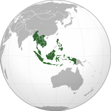
- Region: Southeast Asia
- Area: 4,545,792 km2
- Population: 641,775,797
- Population density: 135.6/km2
- Nominal GDP: $2.557 trillion
- PPP GDP: $7.6 trillion
- GDP per capita: $4,018
- HDI: 0.684
- Demonym: Southeast Asian
- Countries: 11 states
- Dependencies: Christmas Island, Cocos (Keeling) Islands
Geography
Overall, Southeast Asia or Southeastern Asia is a subregion of Asia. It consists of countries that are geographically south of China, east of India, west of New Guinea and north of Australia. Southeast Asia is bordered to the north by East Asia, to the west by South Asia and Bay of Bengal, to the east by Oceania and Pacific Ocean, and to the south by Australia and Indian Ocean.
The region is the only part of Asia that lies partly within the Southern Hemisphere, although the majority of it is in the Northern Hemisphere. Summing up, Southeast Asia consists of two geographic regions:
1. Mainland Southeast Asia, also known historically as Indochina, comprises Vietnam, Laos, Cambodia, Thailand, Myanmar, and West Malaysia.
2. Maritime Southeast Asia, is also known historically as the East Indies and Malay Archipelago. Specifically it comprises Indonesia, East Malaysia, Singapore, Philippines, East Timor, Brunei, Christmas Island, the Andaman and Nicobar Islands of India, and the Cocos (Keeling) Islands. Taiwan is also included by many anthropologists.
More
Otherwise, the region lies near the intersection of geological plates, with heavy seismic and volcanic activities. The Sunda Plate is the main plate of the region, features almost all Southeast Asian countries except Myanmar, northern Thailand, northern Vietnam, and northern Luzon of the Philippines.
The mountain ranges in Myanmar, Thailand, and peninsular Malaysia are part of the Alpide belt. Further the islands of the Philippines are part of the Pacific Ring of Fire. Both seismic belts meet in Indonesia, causing the region to have relatively high occurrences of earthquakes and volcanic eruptions.
Overall, Southeast Asia covers about 4.5 million km2, which is 10.5% of Asia or 3% of earth’s total land area. Its total population is more than 641 million, about 8.5% of world’s population. It is the third most populous geographical region in the world after South Asia and East Asia. The region is also culturally and ethnically diverse, with hundreds of languages spoken by different ethnic groups.
Ten countries in the region are members of ASEAN. This is a regional organisation established for economic, political, military, educational and cultural integration amongst its members.
Source
Wikipedia with some alterations. Both descriptions are on a Creative Commons Attribution-ShareAlike License. Date: 2018-06-22