The 100 km coast of Jæren in southwestern Norway consists of long sandy beaches, pebbles and rocks. The beaches are among the finest in the world and there are ample opportunities for hikes in scenic surroundings.
The landscape
This stretch of coast on Jæren is for 70 km a protected flora and fauna reserve (“landskapsvernområde”) of national importance, and in some respects also international. The protected area is rather narrow, from a few metres at the narrowest to a few hundred metres at the widest.
The beaches are popular for sunbathing and swimming during the summer, or for surfing and walks all year around. It has been said that Norway’s best surf is found along the beaches of Jæren.

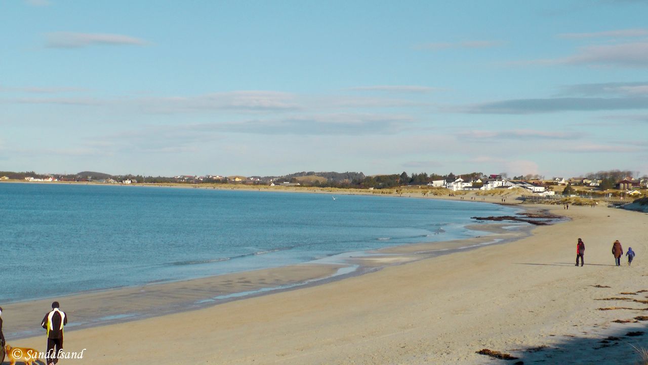
A peaceful beach walk at Solastranda
The entries I’m presenting are concentrated on hikes, short and medium long. My ambition is to introduce the area to the large number of expats in the Stavanger region, in a language common to all. I would also be happy if visiting tourists and armchair readers of this website will find my comments, pictures and videos interesting.
Signposted information on the beaches
“Jærstrendene Protected Landscape Area achieved conservation status in 1977 with the aim of safeguarding a unique natural and cultural landscape that includes distinctive types of coastline. The area includes features of significant geological, botanical, zoological and cultural heritage value. It extends for 70 km from north to south and covers an area of approximately 17 km2.
Approximately 25 km of its length comprises sandy beaches and dunes, while the remainder consists of course pebble beaches and rocky coastline. In addition, 8 areas have been designated as sites for bird conservation, (Ramsar), 10 for botanical conservation, and 4 for geological nature conservation.
Large parts of the protected area are private property, but it is permitted to use the beaches for recreational activities such as walking and bathing. Please show due consideration in the area!”
Read up on more
Get more background information on the geology, flora, fauna, history and people in this article: Jæren – The coastline explained.
The hikes on Jæren
Jæren stretches from Tungenes in the north to Ogna in the south. The variety offered by the landscape makes the coastline ideal for hikes. My hikes include, but are not limited to, the Protected Landscape Area. Below is an overview, sorted in a north to south order.
The distance shown is for the hike one way, exceptions are marked. The links are to posts with descriptions, practical information, pictures and video. The “Video” links lead directly to my videos on YouTube. All hikes are from 2012 and 2013. Click on the miniatures to view them full size, in a new tab.
Tungenes – Sandestranda (Randaberg)
This is as far north as you get on Jæren, the tip of the Stavanger peninsula at Tungenes. Visit the lighthouse and walk on rocks along the seashore to the lovely sandy beach at Sande. If you come here on a Sunday, don’t miss Jæren’s best home baking at the Tungenes Fyr café. (3.9 km) Article. Video.
Sandestranda – Børaunen (Randaberg)
The bay and beach at Sande makes a fine starting point for a walk on the sandy beach, on grass paths, pebbles and boulders out to a headland with two distinct cairns. (2.5 km) Article. Video.
Bø – Vistnes (Randaberg)
This is a varied and wonderful hike, at times not very easy jumping from rock to rock. Large boulders, heathers and grassland, a WW2 fort, old boathouses, picturesque farms and cottages. This hike has it all. At Vistnes the conservation area stops for some kilometres, only to be resumed at Kolnes. (6.4 km) Article. Video.
Vistnes – Vistestranda (Randaberg)
This hike from the popular sandy beach of Viste will take you on an easy trail to a Stone Age cave and a 19th century farm. (3.7 km) Article. Video.
Vistestranda – Endrestø – Kvernevik (Randaberg)
A short and easy hike on a good trail between Viste beach and Kvernevik. To make it less easy, check out the rocky scenery at Endrestø. (1.4 km) Article. Video.
Kvernevik (Stavanger)
The rocks at the tip of Smiodden receive the rythmic pounding of the waves, while the gravel trail winds in the hilly terrain of heather and grassland just inside. You don’t want to miss the memorial on this picture. (3.6 km) Article. Video.
Hafrsfjord
Hafrsfjord is one of the most significant fjords in the history of Norway. The walkable parts are on the eastern side (Stavanger) of the fjord. In this fjord there are a couple of monuments to the crucial Battle of Hafrsfjord in the year 872. Several hikes are described in this article entry, including a couple of videos. (27.9 km)
Jåsund- Tananger (Sola)
This is a remarkable hike on white-washed cliffs between Hafrsfjord Bridge and the very pleasant harbour of Tananger. (6.7 km) Article. Video.
The area south of Tananger is to be avoided: It is filled with very active harbour activity, industrial plants and office buildings all around the bay of Risavika. (6.6 km)
Risavika – Kolnes – Sola beach (Sola)
At this point in the north to south coastal walk we are back in the conservation area again for the remaining distance to Ogna in the south. This is a hike on grassland and sand. The need to cross barbed wire fences makes it a less easy walk though. (3.1 km) Article. Video.
Solastranda (Sola)
This beach is arguably the most visited and most famous of all sandy beaches on Jæren. The Sunday Times even named it the world’s sixth most beautiful beach. (2.8 km) Article. Video.
Sola beach – Ølberg beach (Sola)
The hike runs southwest from Sola beach towards Ølberg. Here we can follow a trail on the dunes, over stones and rocks, and over marshes and fields. Ølberg has a lovely sandy beach, a nice little harbour and extensive WW2 fortifications. (3.5 km) Article. Video.
Ølberg beach – Vigdel beach (Sola)
At Vigdel we find the smallest of the natural sandy beaches on the coast of Jæren. This hike mixes that with fascinating geology and WW2 memories at Ølberg. (2.1 km) Article. Video.
Vigdelneset (Sola)
The trip around Vigdelneset between Vigdel and Hellestø is quite hilly and winding over rocks, wilderness and boulders between two beautiful sandy beaches. The hill of Vigdelveten offers a remarkable panoramic view. (2.5 km) Article. Video.
Hellestø (Sola)
At Hellestø we find one of Jæren’s most popular sandy beaches, summer and winter. It is quite wide and long, with great big sand dunes. The landscape behind the dunes is among the most comprehensive and exciting on the coast. (1.8 km) Article. Video.
Sele (Klepp)
Some say Sele Harbour is the most picturesque of all Jæren harbours, in particular because of the colourful row of boathouses. This hike includes high sand dunes, a wonderful boulder beach and the mouth of the important salmon fishing Figgjo river. (3 km) Article. Video.
Bore – Revtangen (Klepp)
At Bore we find one of the widest beaches on Jæren. The surf is great here. You will be able to go for a walk in the sand and on grass the entire distance to Revtangen, the start of Orre beach. Article. Video. (6.8 km)
Revtangen – Orre (Klepp)
Great beach walk. Walk happily in the sand along the seashore one way and on the sand dunes on the rebound. This trip goes north to Revtangen, but can obviously be extended as far as you want. Have a cup of coffee at Friluftshuset and advance your learning from its permanent exhibition on the Jæren coast. (2.5 km) Article. Video.
Orre – Skeie – Hå Old Vicarage (Klepp & Hå)
Varied hike on grass, gravel roads, boulders and sandy beaches. There are some very fine sandy beaches, unknown to most. This is a tricky hike: Forget crossing the Orre river, watch out for the extensive use of barbed wire fences and electrified fences even inside the protected flora and fauna reserve, there are few fence climbers and attacking birds do hit your head. (9.1 km) Article. Video.
The King’s Road (Kongevegen) between Hå Old Vicarage and Varhaug Old Cemetery (Hå)
The historic road from the 1600s has had royal users, but that was a long time ago. We do not find many remnants from that time. However, we find on this hike a number of other attractions, including Grødalandstunet. Enjoy the lovely cemetery (!) and visit the exhibitions at the old vicarage. (8.5 km) Article. Video from hike. Video from Grødaland.
Varhaug Old Cemetery – Madland – Haarr – Kvassheim (Hå)
Madland and Kvassheim offer small picturesque harbours. If you are driving the coast of Jæren, Haarr is the place to stop to enjoy the pebble beach, the ocean, the waves, the wind, the sky, and the flat farming land of Jæren behind you. The northern part, between Varhaug and Madland is one of the best hikes on the entire coastline. (8.9 km) Article. Video.
Kvassheim – Brusand – Ogna (Hå)
This is a varied hike. Kvassheim has a nice little harbour and lighthouse, and the first few km southwards are on grassland passing boulder and pebble beaches. At Brusand we walk along a very long sandy beach. At Ogna there is a distinct shift in geology – the hills mark the end of Jæren. (9.4 km). Article. Video.
Maps
The total hiking distance is about 128 km including Hafrsfjord. The coastline excluding the fjord amounts to 100 km. (Multiply a kilometre by 0.62 to get the distances in miles.)
Good quality satellite images are found on Finn.no. They are better than Google Maps. Ut.no offers detailed planning maps without satellite images. “Turkart Jæren” is the obvious physical map for a large part of this region. One often reads that the Jæren coastline is about 70 km long. That might be as the crow flies, or at least in terms of the Jærstrendene Protected Landscape Area.
I have made my own illustrations in Google Maps for the sake of this project. The hikes are drawn with fairly good accuracy, sometimes augmented by GPS tracking using the Endomondo app. The location of my hikes are indicated on the map below, alternating with blue and green lines just to show the different hikes. Distances marked with a red line are not worthwhile.
Further reading
There is a separate article offering background information on the geology, flora, fauna, history and people: Jæren – The coastline explained.

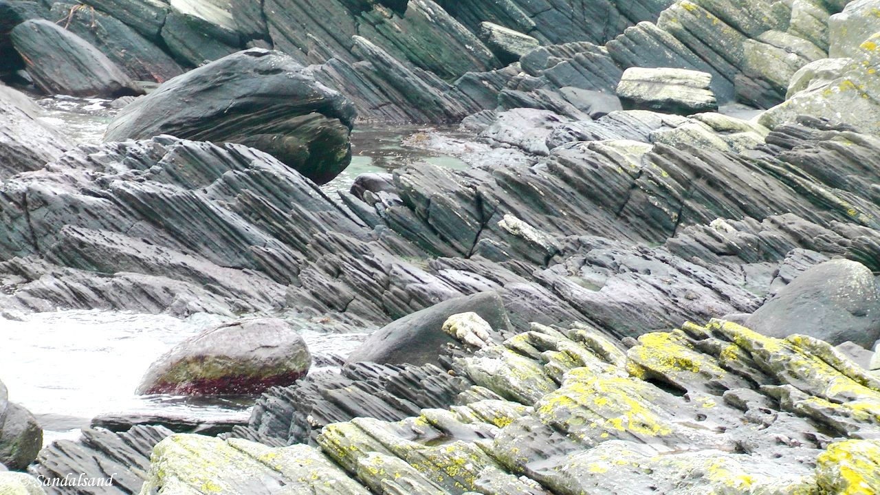
Phyllite rocks in Nudavika, Sola
Stavanger Trekking Association arranges many walks. The Norwegian web site Ut.no offers nationwide descriptions of outdoor exercises. They have a handful from Jæren as well.
There are local people who engage themselves in walks in the region and post their experiences online. The site called Turanbefalinger.com includes many trips from the coastline and has good descriptions.
Tourist information in English is scarce:
- Official Tourist Information Authority – The Stavanger Region
- Nordsjøvegen – Drive the Viking Path
If you don’t have the letter “æ” on your keyboard when searching the net for information about Jæren, try using “ae” instead like in Jaeren.
What now?
1. Start in the north, at Tungenes and follow my string of entries from Jæren.
2. Spend the next couple of hours watching my YouTube playlist “Jærstrendene”, from the coastline of Jæren.
3. Read the following articles about what else to see and do in the Stavanger region.
Other attractions in the region
If you’re arriving into this region by car from the south, as many do, you’ll be thrilled to read about this string of small and medium sized towns and places along the North Sea Route (Nordsjøvegen, Rv44):
Flekkefjord, the town that was
The Helleren houses in Jøssingfjord
Sogndalstrand, the first Norwegian Cittaslow
Egersund, rich on fish and fear of the almighty
Stavanger’s Old Town.
It’s not unlikely that you will be continuing north from Stavanger, so read my introduction to Western Norway, the fjord country.
The Pulpit Rock – a hike in the mountains
What’s truly amazing is that the sandy beaches on the edge of Jæren’s flat plain, are only a couple of hours from one of Fjord Norway’s most iconic sights: The Pulpit Rock. Named the world’s “Most Breathtaking Viewing Platform” by Lonely Planet the rock can be seen 600 metres above your head on a visiting boat out of Stavanger, or even better: You can stand right on top of it after a fantastic two hour hike. Read my short story here, and even about my other hikes around the fjord this famed Rock is threatening to fall into.
Do you read Norwegian?
For norskspråklige: Jeg har samlet omtalene i en serie med artikler også på nettsiden “Sandalsand Norge”. Artikkel nummer én er her. Kommentarene og illustrasjonene var opprinnelig markant mindre omfattende enn i de engelskspråklige hovedartiklene. Nå er det omvendt, og dessuten har de norske artiklene mer oppdaterte bilder.
Merk at YouTube-videoene alle har norske kommentarer, og kun det. Dersom du har lest så langt som dette, vil du også ha forstått at dette er et kombinert tur- og skriveprosjekt om Jæren, jærstrendene, jærkysten, sandstrender, rullesteinstrender, natur, kulturminner, og i det hele tatt…!

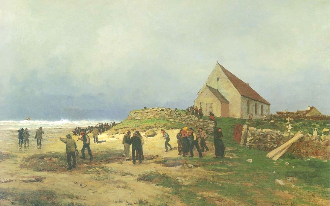
Nicolai Ulfsten (1854-1885) – Stranding on Jæren (1881) (Source: Wikimedia Commons)
The artwork from the coast of Jæren is more properly introduced in the article Jæren – The coastline explained. A number of paintings illustrate the articles.


